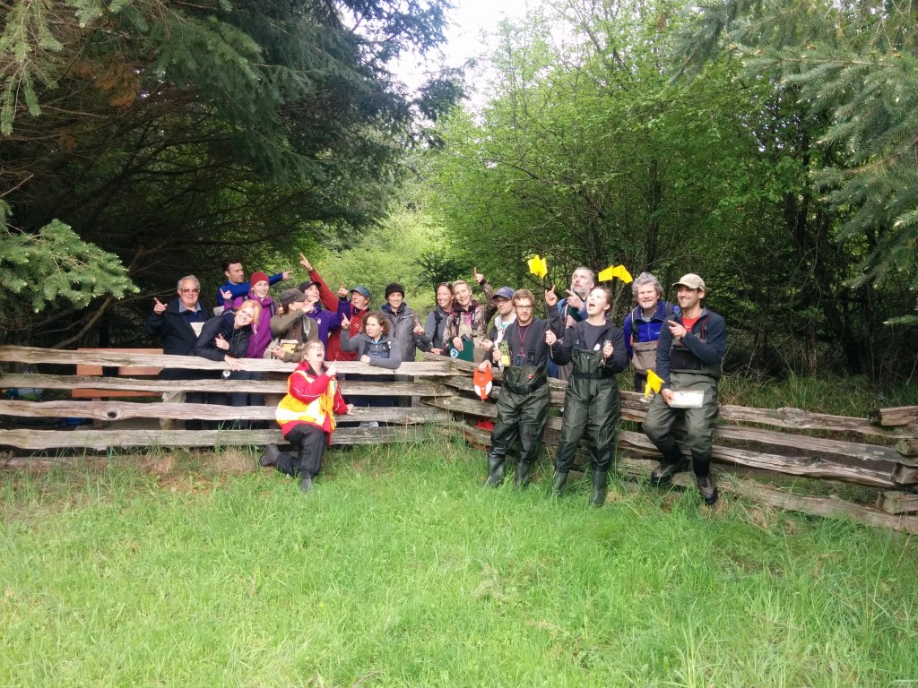
The first Wetlandkeepers workshop of 2016 was held in Parksville, B.C. from April 22–24. This workshop, taught by Wetlandkeepers Trainer Michele Jones of Mimulus Biological Consultants, welcomed 19 participants who came to learn about wetlands and how they can help protect them in their communities. A special thank-you goes to Faye with the Mid Vancouver Island Habitat Enhancement Society (MVIHES), a workshop partner, who helped plan and promote the event locally.
The workshop began on Friday evening with group introductions and a wetland presentation. Michele covered the basics of what wetlands are, introduced wetland soils, and taught participants how to classify wetlands into five main types: bogs, fens, swamps, marshes, and shallow open water wetlands.
Saturday started bright and early in the classroom with a discussion on how to monitor wetlands and establish a baseline to track changes over time. Surveying wetlands is an essential step toward their protection. The best way to protect a wetland is to understand its water system and identify risks and influences—both within the wetland and in the surrounding watershed. Michele emphasized the role of stewardship groups and how they can significantly impact local wetland conservation through landowner outreach and education.

One key part of surveying a wetland is collecting zonation data. Zonation refers to observing the changes in vegetation from the drier upland areas down to the wetter parts of the wetland. These zones can often be identified in airphotos and traced onto mylar paper. By comparing what we see in airphotos with what we find in the field, we can sketch and measure each zone’s length, providing a reference for monitoring changes over time.
We then headed into the field to zone the large wetland at Rathtrevor Beach Provincial Park. Michele taught the group how to use a compass, and participants split into six groups to complete a compass navigation exercise. Each group selected a location in the field to place an animal marker and was given three different compass headings with specific distances. After completing all three legs, the goal was to end up back at their original marker—and all six groups succeeded!
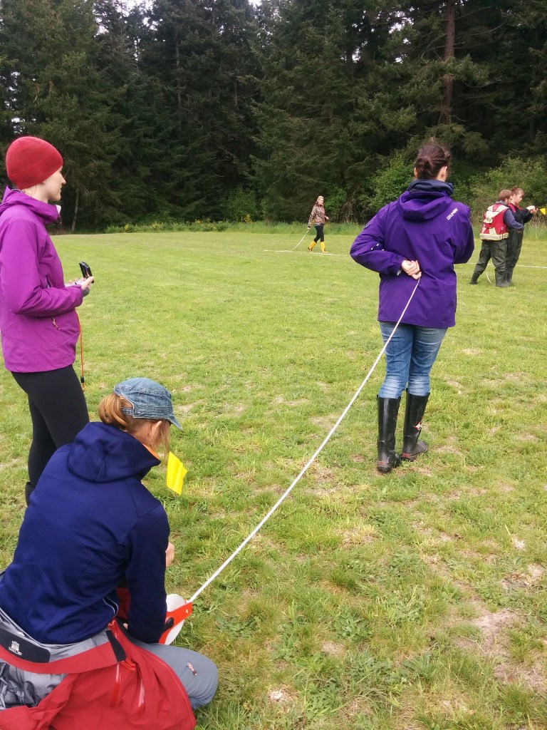
Next, Michele guided the group through the first sections of the Wetlandkeepers long-form survey, with a focus on transects. Now confident using a compass, we laid a baseline across the wetland and marked six evenly spaced transects. Each group followed the same heading to ensure parallel transects and recorded the lengths of each zone they passed through. Everyone also learned how to navigate the dense swamp zone, which included species like rose and other shrubs. We wrapped up fieldwork by collecting a soil sample and classifying it using the Von Post scale. The soil at this site was sandy with some loamy characteristics.
Back in the classroom, everyone calculated scale conversions to transfer their field transect data onto their mylar sketches, marking zone boundaries and vegetation types.
Participants returned on Sunday to focus on wetland birds and vegetation. In the classroom, Michele explained how to design bird, vegetation, and wildlife surveys. She highlighted important factors to consider before heading out, including breeding seasons, migration periods, weather conditions, and plant flowering times. She also recommended checking the BC Species and Ecosystems Explorer to identify any at-risk species and reviewing past surveys to determine whether the area had already been studied.
We completed a vegetation ID activity indoors to practice using dichotomous keys. Species identified included Himalayan blackberry, Sitka willow, Pacific crabapple, and hardhack.
Later, we returned to Rathtrevor Park for birding and plant identification. We heard calls from ravens, olive-sided flycatchers, red-breasted nuthatches, mallards, red-winged blackbirds, robins, hummingbirds, orange-crowned warblers, flickers, pileated woodpeckers, kinglets, and Pacific chorus frogs.
We then put our skills into practice by setting up vegetation quadrats. After establishing a baseline, each group laid transect lines and placed quadrats in different wetland zones. In each quadrat, participants identified all plant species present and estimated percent cover. These findings were recorded in the long-form survey and brought back to the classroom for further review.
To wrap up the workshop, we discussed how participants can get involved with local stewardship groups to continue wetland monitoring and surveying. Faye from MVIHES shared opportunities for community involvement. She also presented a video created by Julie Pisani from the Regional District of Nanaimo about a watershed mapping and inventory project in partnership with Vancouver Island University (VIU). Several participants signed up to assist with the project!
Thank you for stopping in to read about our workshop. See more photos from the workshop here.
Thank You to Our Funders
We extend our sincere gratitude to the following funders for their generous support of our wetland education and restoration initiatives:
- Environment and Climate Change Canada
- Wildlife Habitat Canada
- Province of British Columbia
- The Boag Foundation
Thank you for your ongoing commitment to conserving British Columbia’s wetlands and wildlife.

Leave a comment