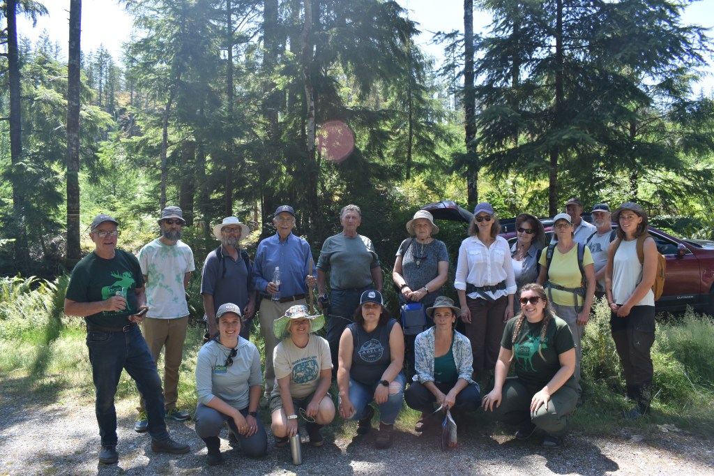
With fall weather in full swing, it’s time to look back on some of the educational workshops the BCWF’s Wetlands Education Program (WEP) ran this summer! From exploring fens and marshes, to swamps and other wetlands, the WEP team connected with passionate individuals and local projects across coastal B.C.
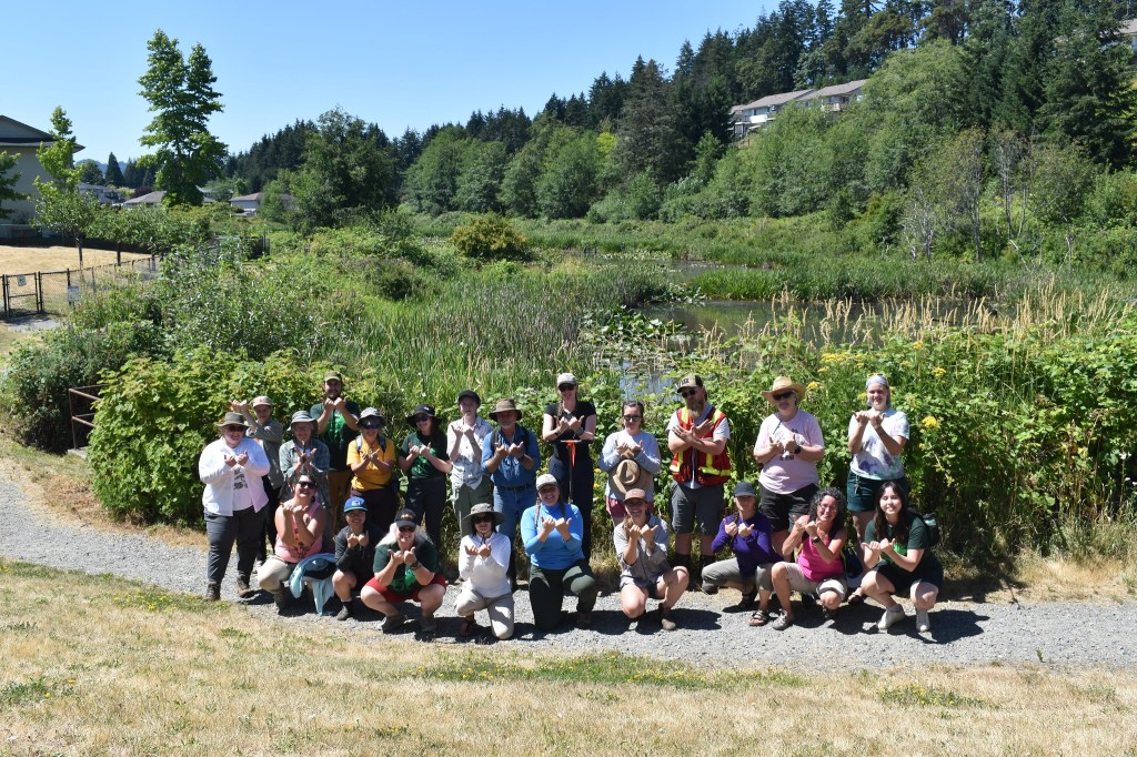
To kick off our summer season, we travelled to the Millard Learning Centre at the Galiano Conservancy Association (GCA). From June 7-9th, the WEP team was grateful to spend time learning on the traditional territories of the Hul’q’umi’num speaking peoples on what is now commonly known as Galiano Island–one of the Southern Gulf Islands–for the first Wetlandkeepers workshop of 2024.
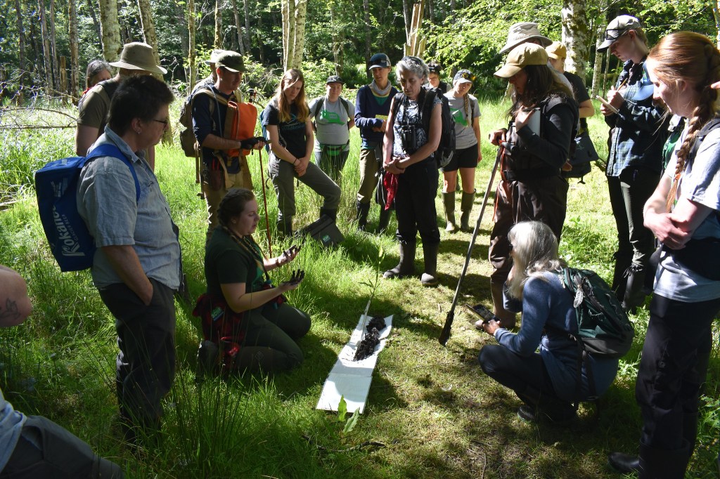
On the evening of June 7th, 22 participants including environmental professionals, real-estate professionals, out of province keeners, local residents , property owners, and more, joined us to learn about the importance of wetlands. We began the workshop with BCWF WEP Coordinator, Alana, providing an insightful introduction to wetlands includingwhy we should care about them and how we classify them.
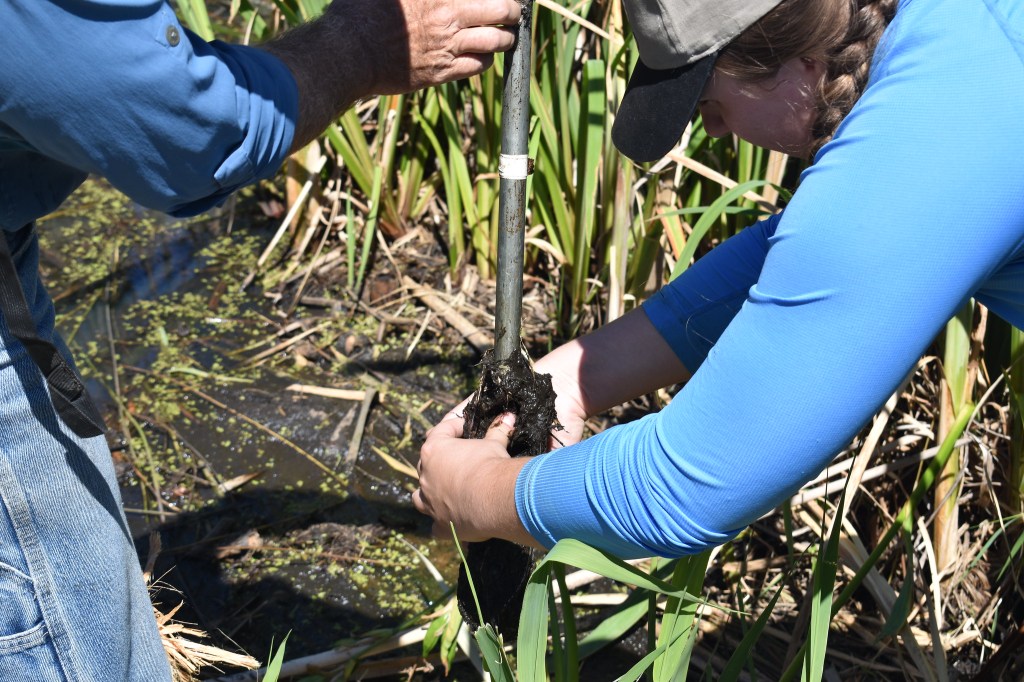
On the following day (June 8th), we met GCA’s Restoration Coordinator, Adam Huggins, who led us on a hike through a property the Galiano Conservancy Association recently acquired after years of fundraising and hard work. Adam pointed out human legacy structures and impacts, as well as areas of current restoration and future restoration potential. At our destination, Great Beaver Swamp, participants applied their newly learned classification skills by examining the wetland’s three essential components: plants, soils, and water.
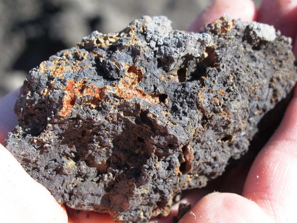
With hands-on soil sampling, we discovered very well-decomposed organic soil atop mineral soil, indicating we were in what’s referred to as a mineral wetland –wetlands with primarily mineral soils. In B.C., the presence of mineral soil would put us in either a marsh, swamp, or shallow open water wetland. Using our new knowledge of the soil in the area and the different plants we were seeing, we discovered that Great Beaver Swamp would be better called Great Beaver Marsh! This is because the dominant plants identified were graminoid species–grasses, sedges and rushes, and the soils were mineral rather than a thick layer of organic/plant material (organic wetlands).
Is it organic or mineral?
Did you looking at wetland soils can help you figure out if a wetland is organic or mineral? Check out these key features to learn the difference between the two!
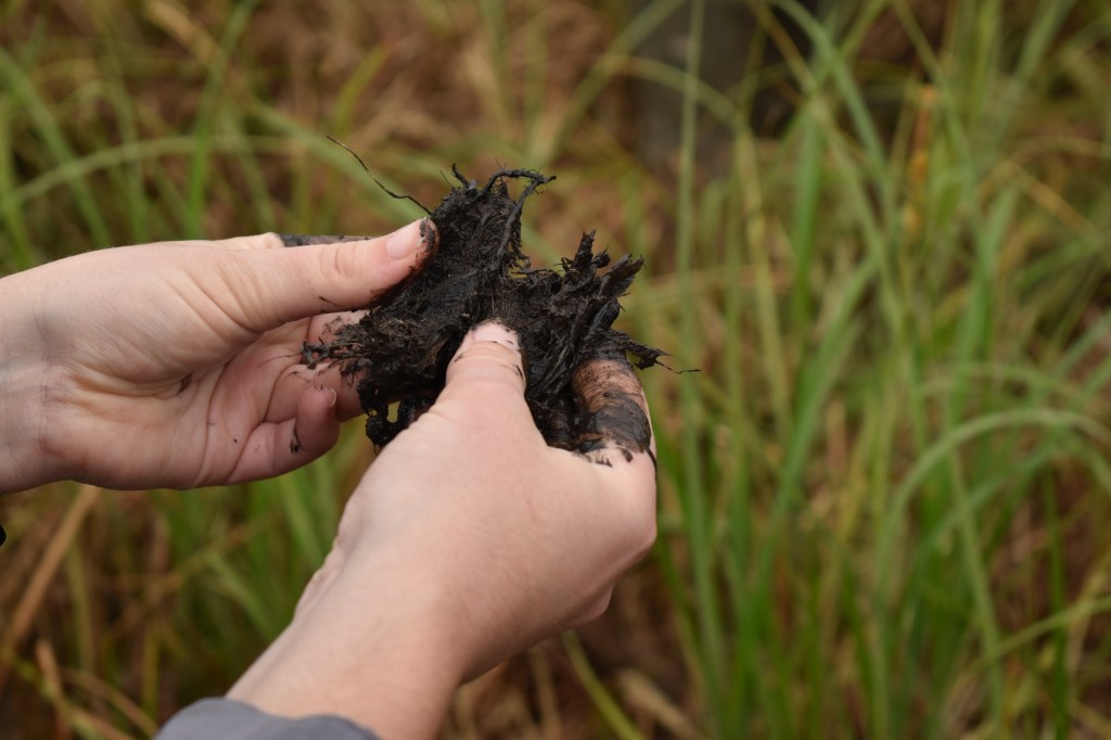
Organic Soil
- Dominated by plant matter (over 30%) that’s at varying levels of decomposition
- Very dark in colour and often has a rotten egg smell
- Indicator of either a bog or a fen – the two types of organic wetlands in B.C.
Mineral Soil
- Composed of ground up rocks – includes sands, silts and clays
- Can have a surface layer of very well decomposed organic matter
- Can have “rusty” streaks in them called mottling or a uniform bluish-grey colour called gleying
- Indicator of either a marsh, swamp or shallow-open water wetland – the three types of mineral wetlands
In the afternoon, Adam showcased GCA’s restored wetlands, including innovative beaver dam analogues (BDAs) they’ve built to support stream and wetland restoration.
Not sure what a beaver dam analogue is, or interested in learning more about them? Check out our blog on beaver-based restoration!
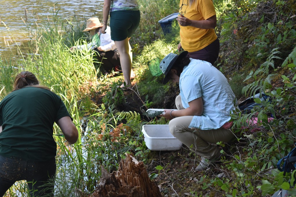
On our last day, we welcomed BCWF’s Engagement Coordinator Kendall McLaughlin, who shared their passion and immense knowledge on B.C.’s Coastal Amphibians. Kendall taught us how to identify different species of frogs and salamanders in both adult and tadpole stage, and took us to a potential future restoration site where participants collected amphibian traps which were set the night before, finding a northern red-legged frog and plenty of benthic macroinvertebrates – or as we affectionately call them, “bugs in the mud.”
Quadra Island Wetlandkeepers
In July, we headed to Quadra Island for our second Wetlandkeepers workshop of the season. The Discovery Islands greeted us with stunning weather and scenery. For this workshop, we were joined by interested locals including several volunteers from the Island Climate Action Network’s Water Security Team who are embarking on a project to map Quadra’s wetlands and aquifers in partnership with the Wei Wai Kai Nation.
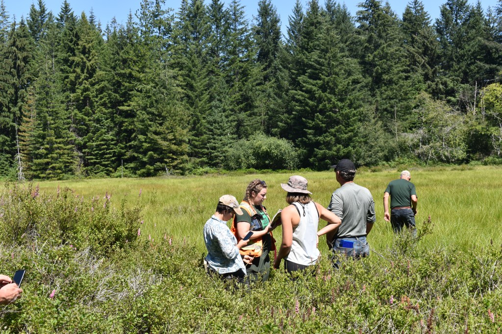
To assist our partners in their large mapping project, BCWF’s Director of Conservation Stewardship – Neil Fletcher – came to talk about best practices for wetland mapping and taught the group how to identify the edge of a wetland. Participants traced what they believed to be the edge of one of Quadra Island’s wetlands – Drew Creek, which we then visited to see how accurate our aerial estimations were. While at the wetland, we got to work with GPS units to create tracks, points, and polygons which were then uploaded to Google Earth to be able to create maps with ground-truthed data.
The next day we put our classification skills to use at a wetland near Village Bay Lake. Many participants had a wealth of local knowledge to share about this large wetland site, including historical drainage practices, local community use and even a time when the area was a horse pasture.
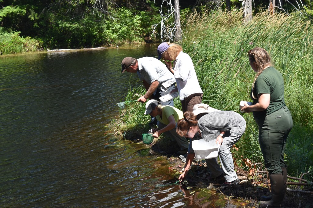
After looking at the soils and plants near Village Bay Lake, we travelled down a nearby forest service road to reach Nighthawk Lake – a wetland area brought to the attention of the Water Security Team by some of their volunteers. A marsh and shallow-open water wetland complex at the outlet of Nighthawk Lake, and home to an old beaver dam became our base for an investigation into benthic macroinvertebrates. Participants started by breaking down benthic macroinvertebrates into three parts:
- Benthic – at or near the bottom of a water body.
- Macro – visible to the naked eye/
- Invertebrate – creatures without a backbone
After identifying a healthy diversity of bugs in the mud we ended the day and the workshop at Byrant Marsh where we got to see many unique plants and hundreds of tiny pacific tree frogs (Pseudacris regilla)!
Nanaimo Wetlandkeepers
We wrapped up our coastal Wetlandkeepers in Nanaimo on July 14th and 15th with a weekend of learning about mapping and monitoring wetlands in urban landscapes, in partnership with the Nanaimo and Area Land Trust. Here we had the privilege to be joined by Snuneymuxw Elder Geraldine Manson who spoke on her Nation and relationship with the land, water, and wetlands. As with all our workshops, we began with an introduction to wetlands to ensure everyone was starting the weekend with the same base knowledge.
Our first wetlands were in Linley Valley – a large wilderness park in the heart of Nanaimo. Here we had the chance to see one of the indicators of hydric soil: mottling in mineral soils. This is where distinct orange-red streaks appear in the soil. These orange-red streaks can appear in the presence of a fluctuating water table which causes a high saturation of soils and a lack of oxygen periodically. We also discovered a layer of charcoal, which is an indicator that some kind of fire occurred at this site in the past, which was confirmed by a long-time local in the group.
Examining the soil is a great way to learn the story of a landscape, and it’s amazing the things you can learn!
To learn about different ways to monitor the health of a wetland, we travelled to Cottle Lake (actually a wetland!) in Linley Valley for a crash course on the Rapid Wetland Health Assessment. Participants evaluated various factors, including disturbance and invasive species presence, plant cover, grazing evidence, and much more to ultimately assign a health score to different sections of the wetland. After a sharing of results amongst the group, Cottle Lake was assigned a score in the 60-80% range, meaning it is “healthy with problems”. Some of these problems included the presence of invasive and disturbance species, and human impacts from trails.
We wrapped up a busy weekend at Brookwood Park – a small wetland park nestled in one of Nanaimo’s residential areas. Here, the group got to take out their phones and learn to use Gaia GPS – an internet-based mapping program. This small wetland area was the perfect spot for participants to learn how to make points in Gaia and map the edge of a wetland.
Although BC’s islands have lost a majority of their wetlands since the 1900s, it was inspiring to meet so many people involved and interested in conserving, protecting, and restoring these important ecosystems along the coast.
Funders
Thank you to everyone who joined us for these workshops! Together, we’re enhancing our understanding and stewardship of BC’s vital wetland ecosystems. And thank you to our funders who made it possible to host these workshops possible to host at no charge: Province of B.C.’s Watershed Security Fund, Wildlife Habitat Canada, FortisBC, Mosaic Forest Management, Canada Summer Jobs.

Leave a comment